
Ambitious Waterway Enhancement Project Launched
Outcomes include increased flood protection and creation of wetland habitat
Quick Summary
- The project will take place over two years and extends from Lake Spafford all the way west.
- Mitigation measures are in place to protect wildlife during construction, including bird and nest surveys and species relocation.
- The Arboretum Waterway is a critical part of the campus's utility infrastructure, capturing stormwater and preventing flooding.
- Community involvement opportunities, such as planting events and fundraising, will be available, with updates provided online and through newsletters and social media.
In Jan. 2022, the UC Davis Arboretum and Public Garden announced the receipt of a $5.4 million grant from the California Natural Resources Agency to complete the Arboretum Waterway Flood Protection and Habitat Enhancement Project. After a period of planning and selecting a contractor, the project construction has begun.
The endeavor follows a successful initial phase completed in 2018, which focused on engineering flow and reintroducing native vegetation from the Wyatt Deck bridge to the eastern end of the Arboretum Waterway near the Davis Commons Shopping Center. With the new grant and a $2.5 million match from the university's deferred maintenance funds, the restoration project will extend from Lake Spafford to the western end of the Waterway, near the Equestrian Center.
The transformative project increases the overall stormwater capacity of the Arboretum Waterway – the largest part of the campus’s stormwater infrastructure – by 6 acre-feet and replaces most of the concrete perimeter with earthen banks, adorned by native trees, shrubs, and understory plants. Sections of the Waterway will be narrowed to facilitate faster water movement, while floodplain benches and emergent marsh plantings will be incorporated to mimic natural wetland habitats.
"We are ecstatic about this project. The first phase is flourishing, and now we can finish the transformation," said Kathleen Socolofsky, assistant vice chancellor and director of the Arboretum and Public Garden. "It has all come together thanks to many thoughtful years of collaboration with our Campus Planning office, faculty and other campus partners."
Did you know?
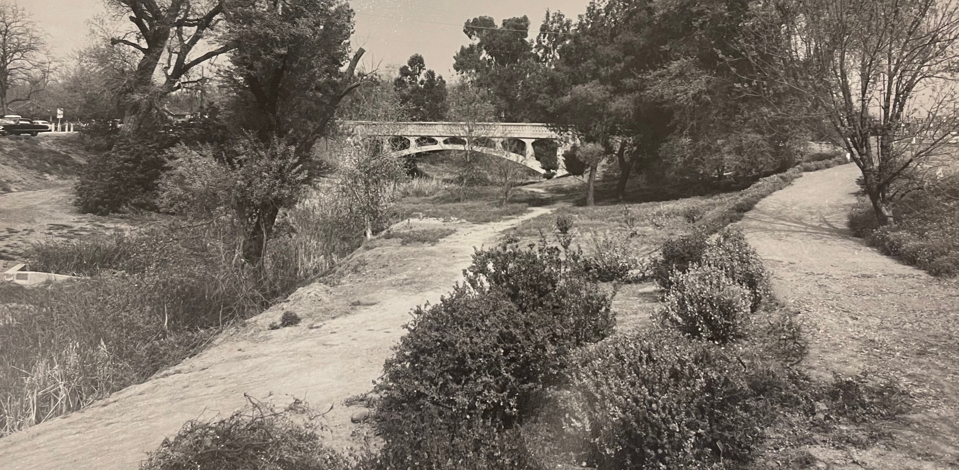
The Arboretum Waterway is no longer part of Putah Creek. Beginning in the 1870s, Putah Creek was diverted to the south of campus and the City of Davis to prevent frequent flooding. The Arboretum Waterway is a constructed pond located where the historic Putah Creek once ran. It is the lowest elevation on campus, the basin for capturing the Davis campus stormwater and the outlet for the campus recycled water. When large rain events occur, excess water spills over a weir at the far west end where it is pumped through a pipe to the relocated portion Putah Creek, eventually meeting up with the Sacramento River.
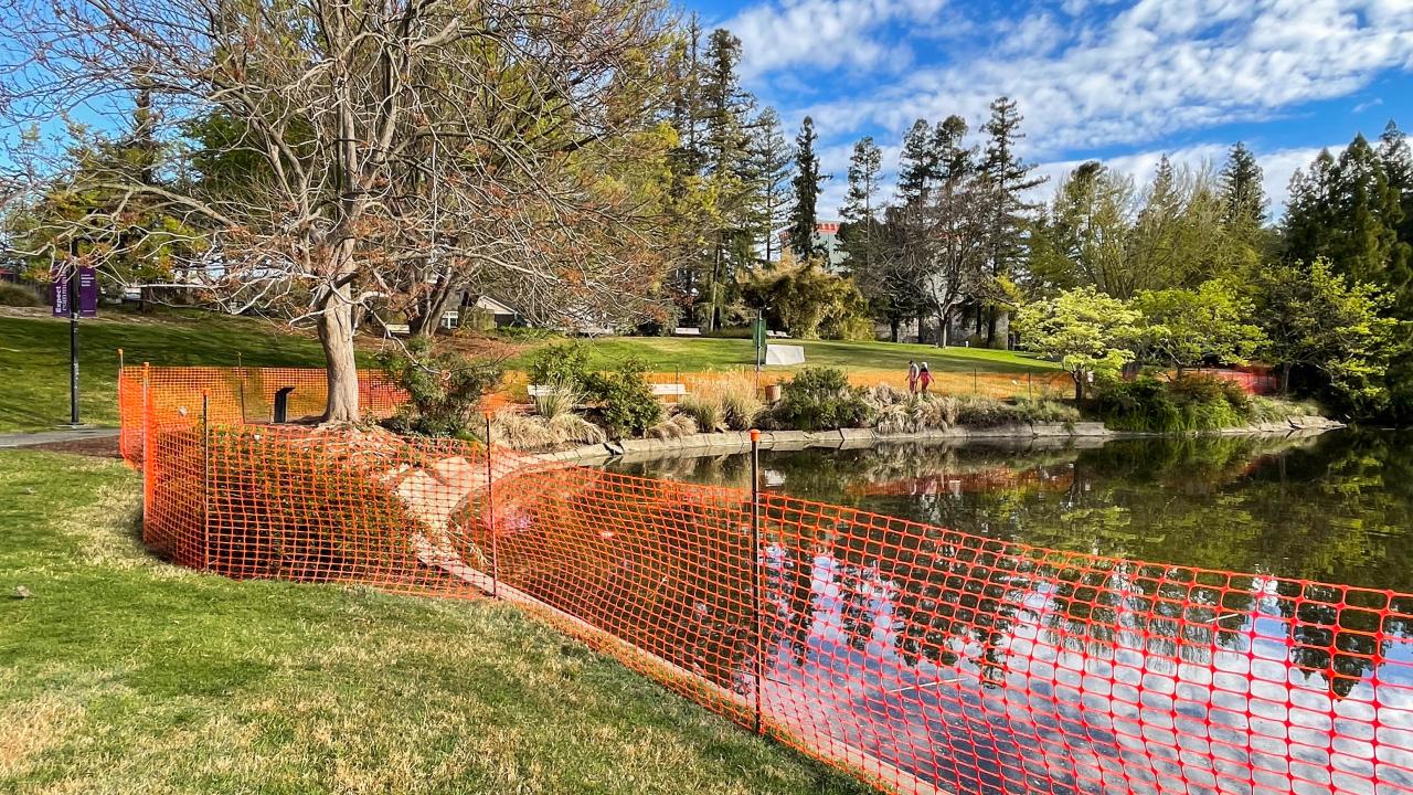
The project will take place over two years from April to about November each year. This year, the public will only experience minor detours during construction. What visitors will see is fencing, some chain link and lots of orange safety barriers around the Waterway as contractors begin to drain and re-shape the banks. And, similar to the first phase, concrete weirs, engineered to help manage the flow of the water, will also be constructed.
"In addition to protecting the campus from flooding, the effort to transform the waterway into a sanctuary that offers enhanced recreational opportunities for our community while fostering a thriving habitat for native wildlife is huge," said Nina Suzuki, waterway steward for the UC Davis Arboretum and Public Garden. “Having to deal with all the fencing and disruption will be worth it!”
“We ask for your patience as it’s going to get messy and possibly a bit stinky when the muck at the bottom of the waterway is initially exposed.”
During the first three weeks of construction, the public will see the water drained from Lake Spafford, the area near Mrak Hall, to the land bridge at Putah Creek Lodge Drive. A year from now, contractors will begin the same process from the land bridge to the end of the Waterway.
In accordance with the California Department of Fish and Wildlife, multiple mitigation measures are taking place to protect the fauna that call the Arboretum Waterway home. These measures include bird and nest surveys to determine safe working distances, as well as the relocation of fish, turtles and other aquatic species to unimpacted areas nearby. Arboretum plant collections along the Waterway will also be monitored and protected during construction.
As the project proceeds, opportunities for community and volunteer involvement are planned from large-scale planting events to fundraising for additional amenities. Regular updates will be available online. The community can also stay informed via the Arboretum and Public Garden's email newsletter or social media channels.
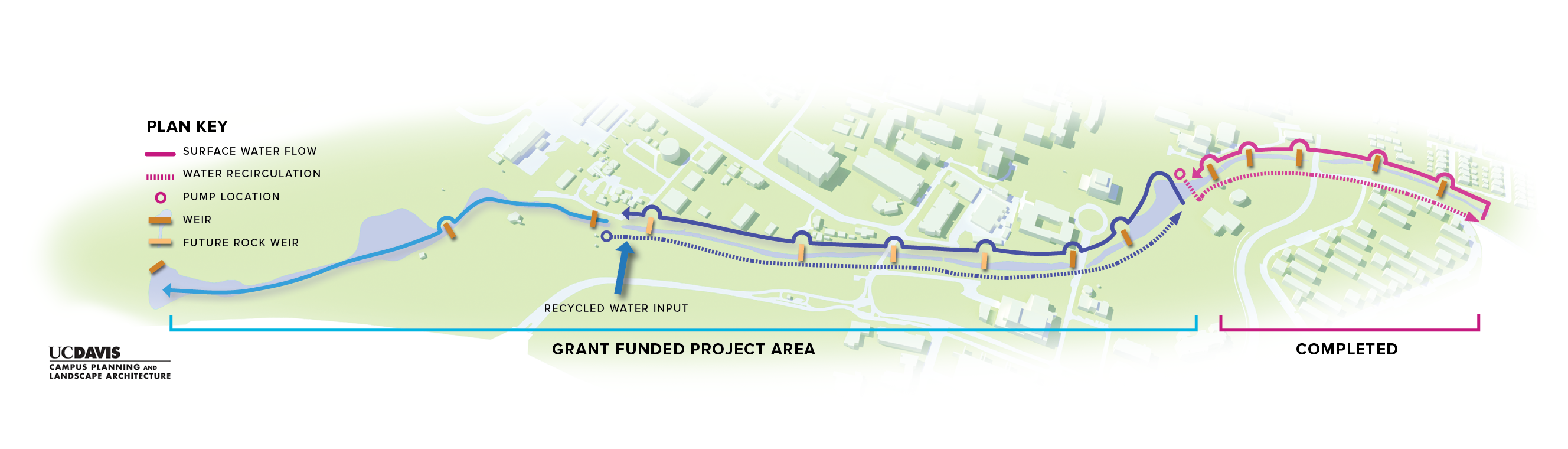
Vision for the Arboretum Waterway
Learn more on the Arboretum Waterway Flood Protection and Habitat Enhancement page.
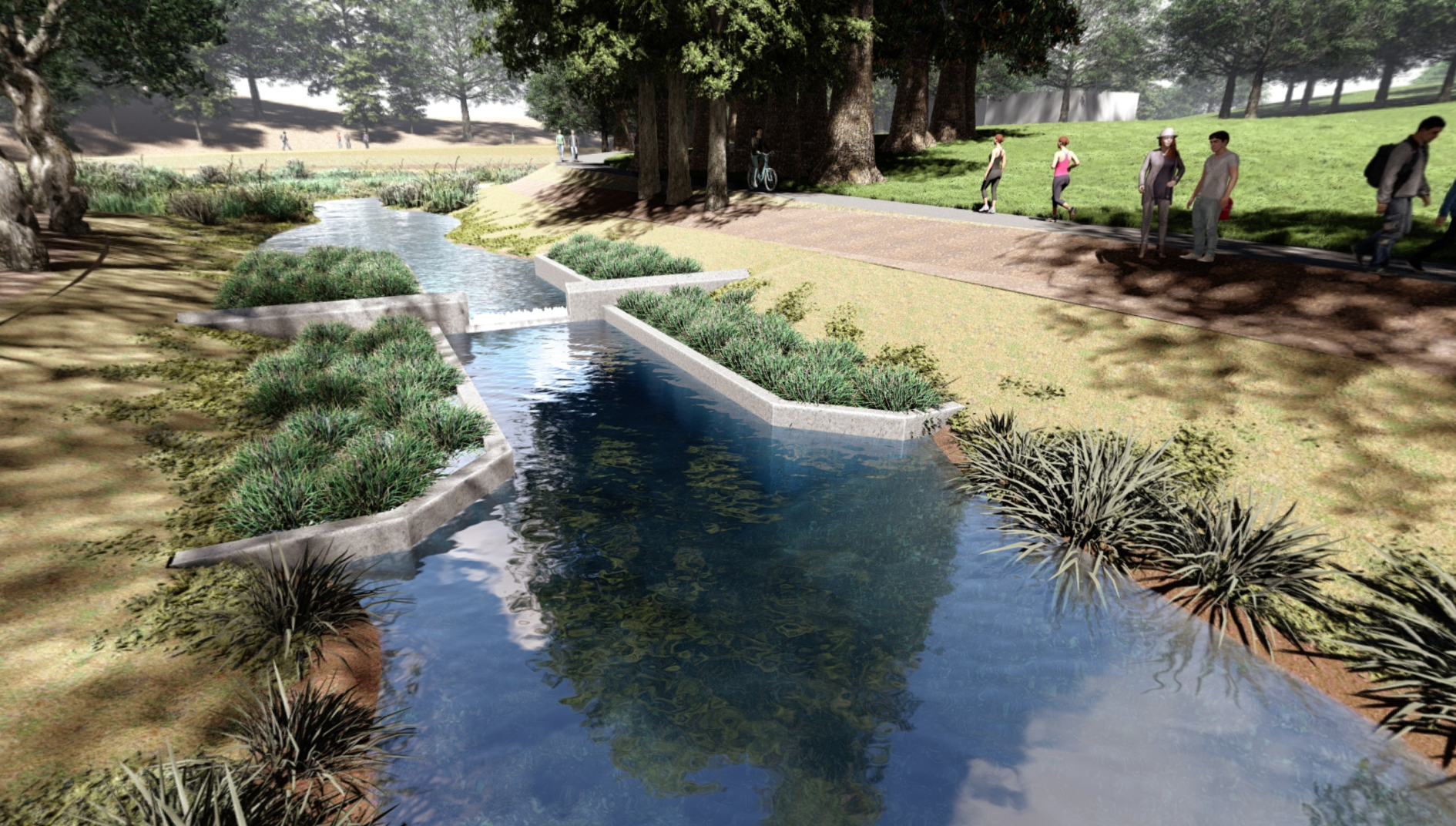
Photorealistic rendering of one of the concrete weirs that helps regulate the flow or water. Three more of these weirs will be added along the Arboretum Waterway.
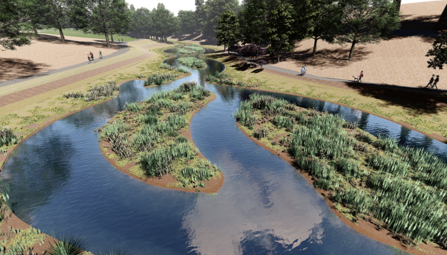
Photorealistic rendering of the floodplain benches and emergent marsh plantings that are part of the design for the western-most portion of the Arboretum Waterway.
Construction Area
The Arboretum Waterway Flood Protection and Habitat Enhancement Project starts where the phase one area ended, at the bridge near Wyatt Deck. This phase picks up where the other left off and goes all the way to the end. Download a larger version of the map below.
Additional project information can be found on the UC Davis Design and Construction Management page including the project manager, contractor and completion status.